Developer Fantasy vs. FEMA Reality
Pat Neal's 3H Ranch - proposes 6576 dwelling units on 2727 acres from Clark Rd. to 681 at I-75. But does the land support this density?
Here is Neal's vision of the land:
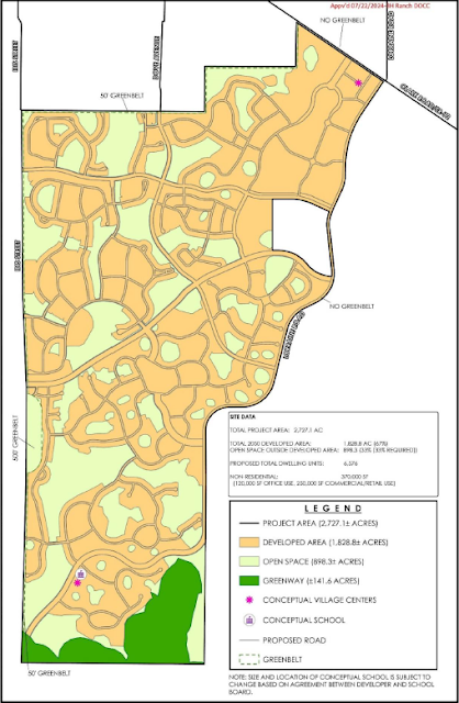 |
| Neal Proposal for 3H Ranch Here is the official FEMA Flood Map for the same area: |
All blue is AE floodplain which means it should all be Greenway.
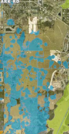 |
| Current FEMA floodplain map: |
The applicant may be PROPOSING to change the designation from AE to AH but that would be subject to a submittal and approval by FEMA. Even if this could be changed, the current FEMA maps are official, adopted, and should stand for this rezone. As such, the answer to the last question should be that zoning should be based upon the official County flood maps, not a separate analysis by the developer which has not been approved and so reflected on the official maps.


Comments
Post a Comment